The page uses cookies to provide necessary website functionality, and improve your user experience. More information
City of Niš
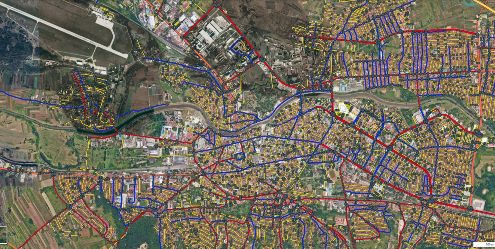
Reference road network map for the Directorate for City Construction
Digitisation of national and local roads and streets through residential areas in the city of Niš
City of Niš
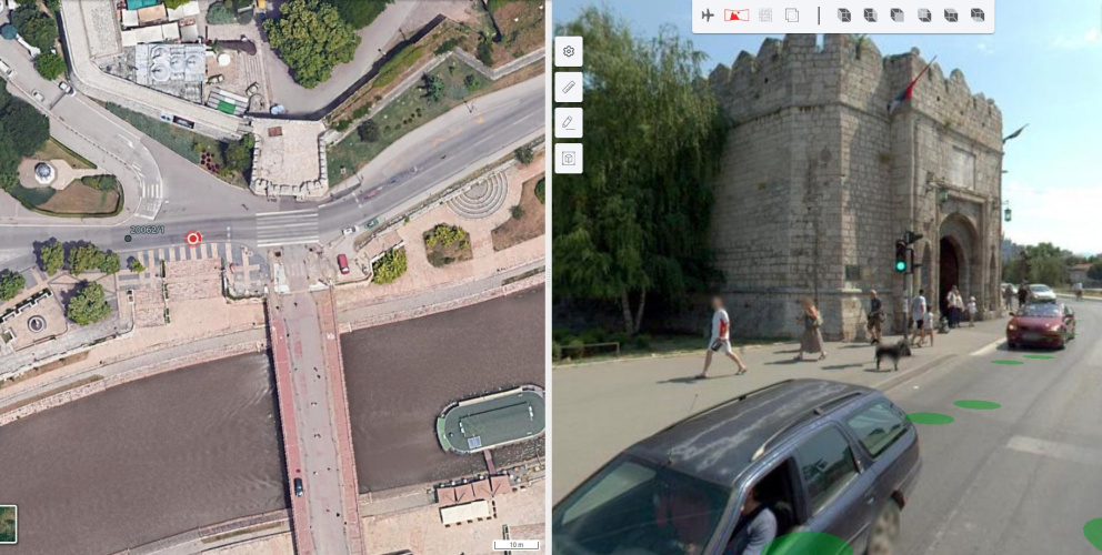
3D layer editor
3D layer editor - utilizing point clouds and panoramic images
City of Niš
Network of roads
The starting and ending points, lengths and graphic representation of the streets are given in the reference system of the network of roads and streets in the territory of the city of Niš.