The page uses cookies to provide necessary website functionality, and improve your user experience. More information
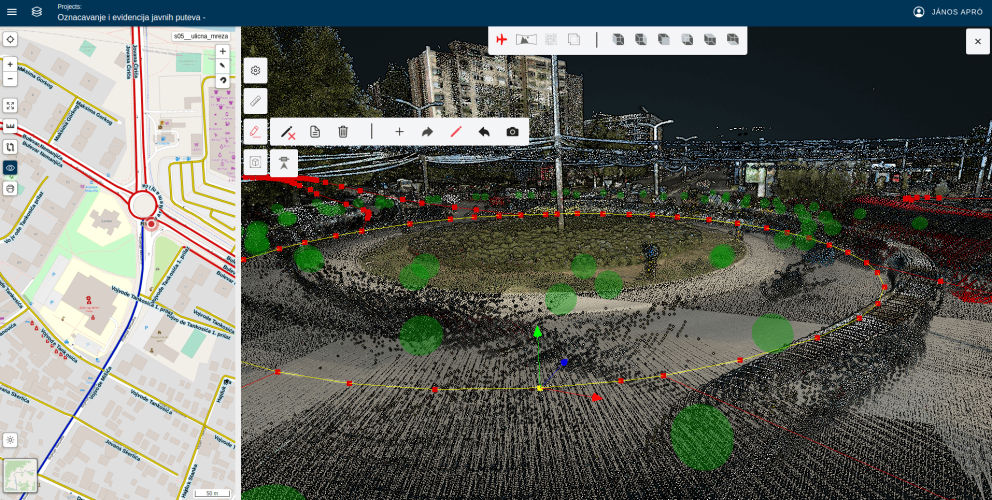
2D / 3D Editor
Manage your GIS data using 3D point cloud and 2D map digitizing tools
- 3D / 2D3D / 2D digitizing tools and measurements
- assets formscustomize asset attribute forms
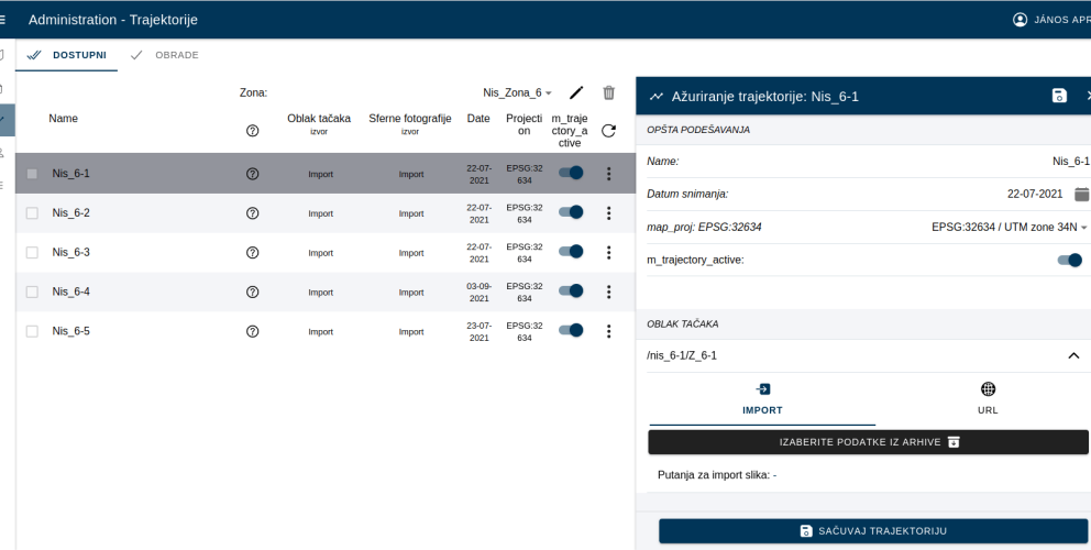
- pointclouds, panorama spheresadd pointclouds and panoramic images to your project from cloud resources
- import point cloudimport point cloud in LAS / LAZ or Potree formats
- processingprocessing panoramic images: anonymization, image size optimization
- collaborationcollaboration between remote teams
- export exporting spatial data in various GIS formats
2D / 3D Editor
Drawing tools
- Draw lines, polygons, point on a 2D map or 3D point cloud
- Add panoramic sphere images (3D)
- Undo / Redo features
- Snap to line/ vertex
- Translate feature (3D)
- ClipBox (3D)
2D / 3D Editor
Point Cloud Library
- import point cloud in LAS / LAZ or Potree formats
- convert LAS files to Potree format
- share point clouds and panoramic images between applications
- processing tools: anonymization, image size optimization