

The page uses cookies to provide necessary website functionality, and improve your user experience. More information
Powerful online GIS
for displaying and processing data
in 2D and 3D space

SmartGIS
2D / 3D viewer and editor
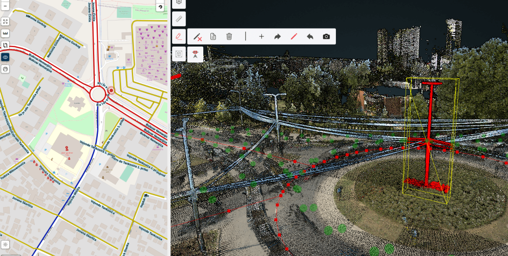
- 2D / 3D digitizing tools and measurements
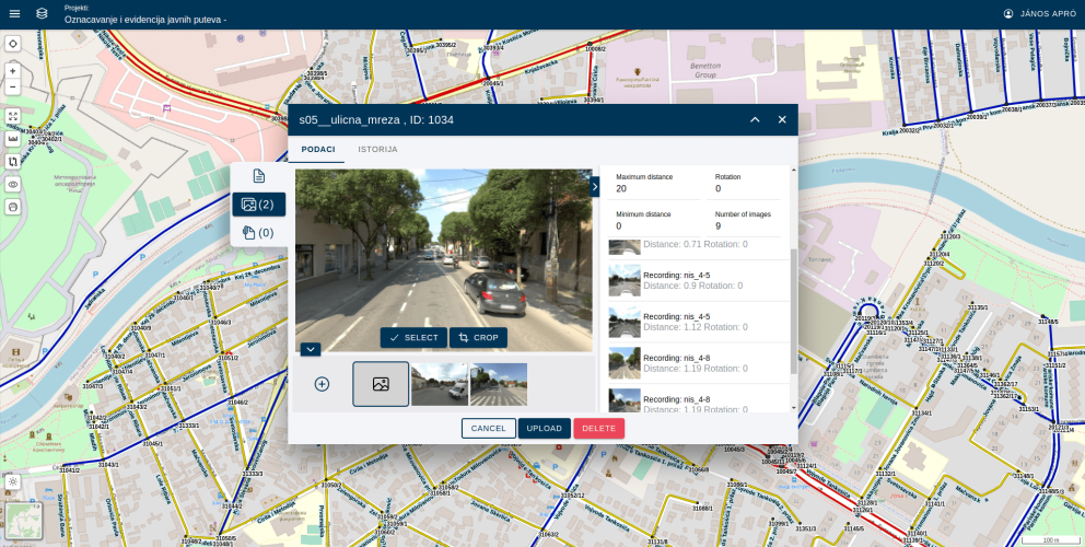
- using LiDAR point clouds and spherical photos as a result of Mobile Mapping recordings
- using orthophoto and point clouds recorded by UAV technology obtained by photogrammetry
SmartGIS
Web GIS
- a complete GIS solution that works in a web browser
- create datasource library from your spatial data or cloud resources
- show massive data using vector and raster tiles
- manage your teams
SmartGIS
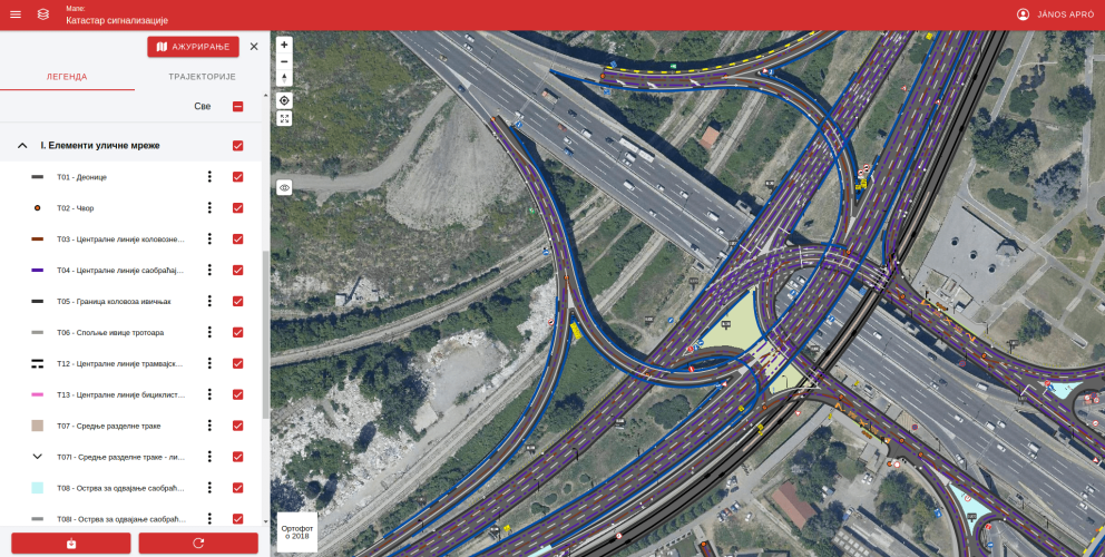
Asset management
- create asset layers from your own data
- customize asset attribute forms
- add photos and attachments
- add a sequence of tasks into a workflow management system
- export asset layers in various formats